China Geography
 China, with an area of almost 9,600,000 square kilometers, is situated in the eastern part of Asia, on the west coast of the Pacific Ocean. China extends 5,500 kilometers (3,400 miles) from north to south, and it stretches 5,200 kilometers (3,100 miles) from west to east. China spans 5 international time zones from east to west. When the sun is shining brightly over the Wusuli River in the east, the Pamire Plateau in the west is in the early hours of the morning. China reanges from mostly plateaus and mountatins in the west to lower lands in the east with, two-thirds of its territory covered by mountains, hills and plateaus.
 Of twelve highest peaks in the world, seven are located in China. The highest mountain in the world, Mount Qomolangm (8,828m) stands on the border between China and Nepal. China also has a large number of rivers. The inland river system accounts for 36 percent of the total land area in China, more than 1,500 square kilometers with a catchment area exceeding 1,000 square kilometers. The principal rivers flow from west to east to the Pacific Ocean, including the Yangtze River, the Yellow River, and the Amur, and some towards south including the Pearl River, Mekong River and Yarlung Zangbo River.
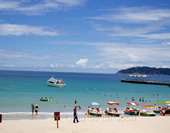
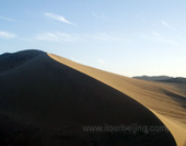
 China is also a country with numerous lakes, with approximately 2,800 natural lakes with total area of more than 80,000 square kilometers. In the east, along the shores of the Yellow Sea and the East China Sea there are extensive and densely populated alluvial plains. Southern China is dominated by hills and low mountain ranges. In the west, the north has a great alluvial plain, and the south has a vast calcareous tableland traversed by hill ranges of moderate elevation, and the Himalayas, containing Earth's highest point, Mount Everest. The northwest also has high plateaus with more arid desert landscapes.
Your Question & Quick Answer*We welcome and appreciate your questions & reviews


Booking Procedures | Terms & Conditions | Payment Methods | Links | Site Map | About Us | Contact Us | Travel Agent
Copyright 2008, All rights reserved.. itourbeijing.com ,china culture, china introduction
TEL: 86-10-85711972 (Universal) 1-888-288-9328 (North America) E-mail: contact@itourbeijng.com
Home | China Tours | Beijing Tours | Tibet Tours | China Travel | Beijing Travel | Shanghai Travel