Dali Maps
Dali, full name as Dali Bai Autonomous Prefecture, is located in the central west of Yunnan Province. The coordinates of Dali are 35°1' 60 N / 37°22' 60 E on the map. It lies on a fertile plateau between the Cangshan mountains to the west and Erhai lake to the east. The traditional inhabitants of Dali are the Bai and Yi minorities. The administrative area covers an area of 29,459 km² and holds a population of 3,47 million.
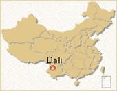 Dali Location Map
 Pre | Next
Your Question & Quick Answer*We welcome and appreciate your questions & reviews


Booking Procedures | Terms & Conditions | Payment Methods | Links | Site Map | About Us | Contact Us | Travel Agent
Copyright 2008, All rights reserved.. itourbeijing.com ,china map, china cities maps
TEL: 86-10-85711972 (Universal) 1-888-288-9328 (North America) E-mail: contact@itourbeijng.com
Home | China Tours | Beijing Tours | Tibet Tours | China Travel | Beijing Travel | Shanghai Travel